Marine Protected Areas
The South Atlantic Fishery Management Council’s Marine Protected Areas (MPAs) are a network of marine environments managed to recover overfished stocks and maintain healthy fish stocks, fisheries, and associated habitats. SAFMC MPAs may include naturally occurring, artificial bottom, or water column habitats. They may prohibit harvest on seasonal or permanent time periods to achieve desired fishery management goals.
Use the interactive map and drop-down menus below to explore the Council’s MPAs.
Deep-water MPAs
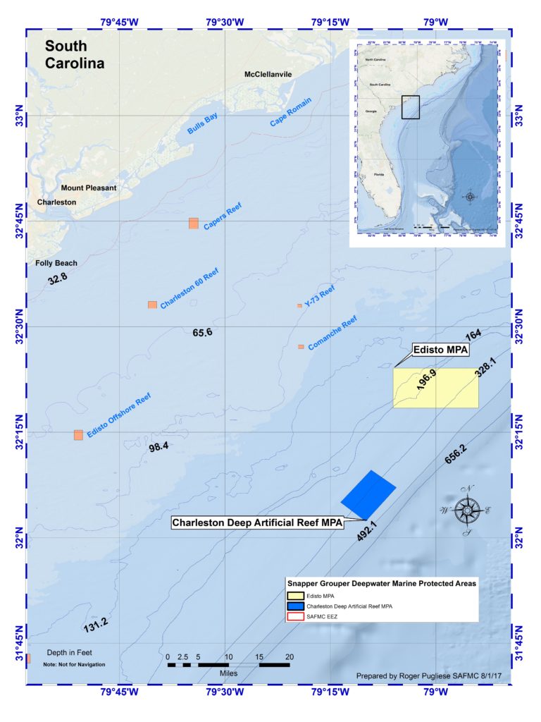
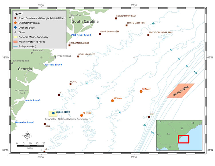
Eight MPAs are in place in the South Atlantic to protect a portion of the long-lived, “deep water” snapper grouper species such as snowy grouper, speckled hind, and blueline tilefish. The MPAs range in size and include both natural habitats and artificial reefs.
A System Management Plan review evaluates the efficacy of the MPAs in meeting management objectives. A System Management Plan Workgroup recommends items including research and monitoring, outreach and education, resource protection, management effectiveness, and site characterizations of the protected areas.

Deep-water MPA Regulations
- No fishing for or possession of any snapper grouper species.
- No bottom longline gear allowed.
- Vessels (both commercial and recreational) may transit (direct, non-stop progression) through the MPAs with snapper grouper species onboard with fishing gear appropriately stowed.
- Trolling for pelagic species such as tuna, dolphin, mackerel, and billfish is allowed within the MPAs.
Deep-water MPA Descriptions


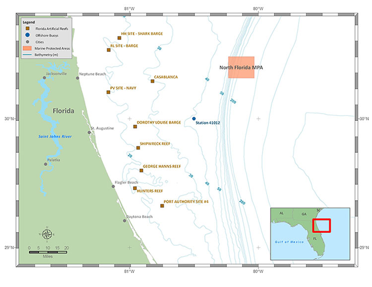

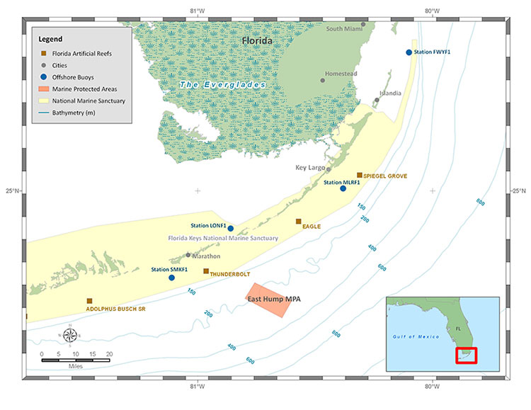
Oculina Experimental Closed Area
In 1994, the South Atlantic Council created the Oculina Experimental Closed Area (OECA), which closed the area to all bottom fishing indefinitely in order to evaluate the effectiveness of the reserve for the management and conservation of snapper grouper populations. The OECA is located within the Oculina Bank HAPC.
Oculina Experimental Closed Area Restrictions
In the closed area, no person may:
- May fish for snapper-grouper species in the area or retain snapper-grouper in or from the area (any snapper-grouper taken incidentally by hook-and-line gear must be released immediately by cutting the line without removing the fish from the water).
- Use a bottom longline, bottom trawl, dredge, pot, or trap.
- If aboard a fishing vessel, anchor, use an anchor and chain, or use a grapple and chain.
- Fish for rock shrimp or possess rock shrimp in or from the area on board a fishing vessel.
- The possession of Oculina coral is prohibited.
Spawning Special Management Zones
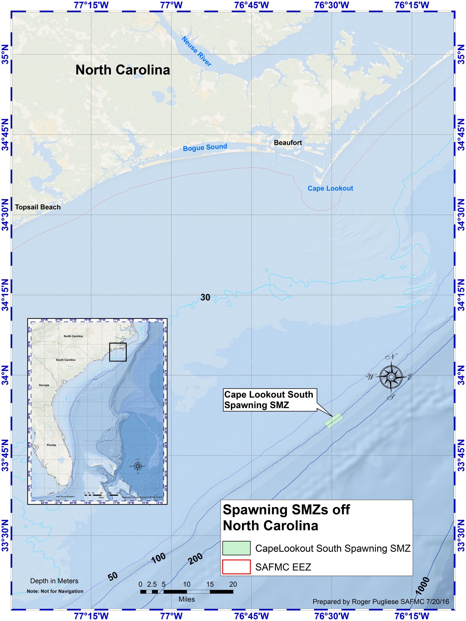
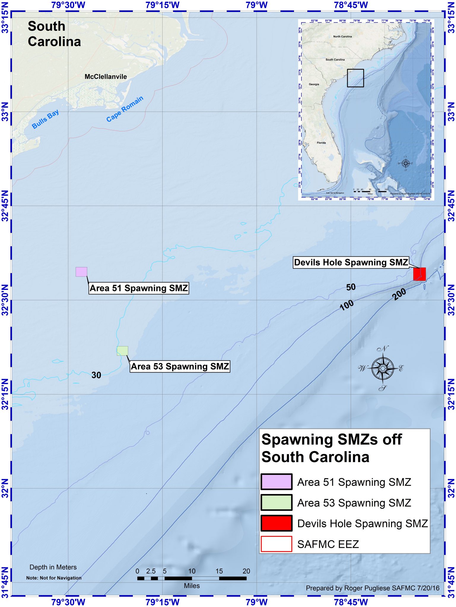
The Council established five Spawning Special Management Zones (Spawning SMZs) that became effective on July 31, 2017. Fishing for, retention of, and possession of snapper-grouper species is prohibited year-round within the Spawning SMZs. There is also a prohibition on anchoring by fishing vessels. Vessels may transit through the areas with snapper-grouper species onboard, provided applicable transit requirements are met.
The Council created these areas because some snapper-grouper species gather in consistent areas to spawn that have favorable habitat or oceanographic conditions. These predictable spawning locations can make the spawning fish particularly vulnerable. During development of Snapper Grouper Amendment 36, the Council identified areas believed to provide important spawning habitat for multiple snapper-grouper species and designated five of these areas as Spawning SMZs.
Three of the five Spawning SMZs were established with a sunset provision, meaning the regulations for those areas would expire unless the Council took action to retain them. The sunset provision provided an opportunity for the Council to revisit the areas after additional research, monitoring, outreach, and compliance activities identified in the System Management Plan could be conducted.
System Management Plan for Spawning SMZs
The Council, working with stakeholders and state and Federal partners, developed a System Management Plan (SMP) to guide research, monitoring, outreach, and management of the Spawning SMZs. The SMP identified information needs, recommended activities, and evaluation metrics that could be used to assess the areas and inform future Council decisions.
In 2026, the System Management Plan Workgroup updated the SMP to document work completed since the Spawning SMZs were established, identify remaining information needs, and recommend priorities for future research, monitoring, outreach, and management. The workgroup was presented research that found multiple species were observed in spawning condition (likely spawning within 24 hours based on analysis of reproductive samples) in the Spawning SMZs, but compliance and enforcement remained a challenge.
The Workgroup also completed an evaluation of the Spawning SMZs using available information to assess the areas relative to the goals and objectives established through Amendment 36. Based on its review, the Workgroup recommended retaining the existing regulations for the Spawning SMZs. The updated SMP and evaluation reports are designed to provide the Council with information to consider as it determines the future management of these areas.
Spawning SMZ Regulations
- Inside the spawning SMZ, fishing for, retention, and possession of fish species in the snapper-grouper complex are prohibited year-round by all fishers.
- Anchoring inside spawning SMZs is prohibited (except for Areas 51 and 53).
- Transit through the spawning SMZs with snapper-grouper species onboard is allowed if the gear is properly stowed.